Entulu – Melatai FMU has a total licensed area of 63,890 Ha, forming partial Baleh Protected Forest which falls inside the Baleh Hydro Project area. The FMU area covers a total area of 55,112 Ha., fallen within HOB and divided into 25 coupes.
The Entulu – Melatai FMU was previously under Forest Timber Licence No. T/3155 which was first issued to Hak Holdings Sdn. Bhd. on 3rd December, 1985 and subsequently transferred to Up-Active Sdn. Bhd. In October, 2001 and followed by Interglobal Empire Sdn. Bhd. (T/3476).
The Entulu – Melatai FMU is a re-entry hill timber Mixed Dipterocarp Forest.
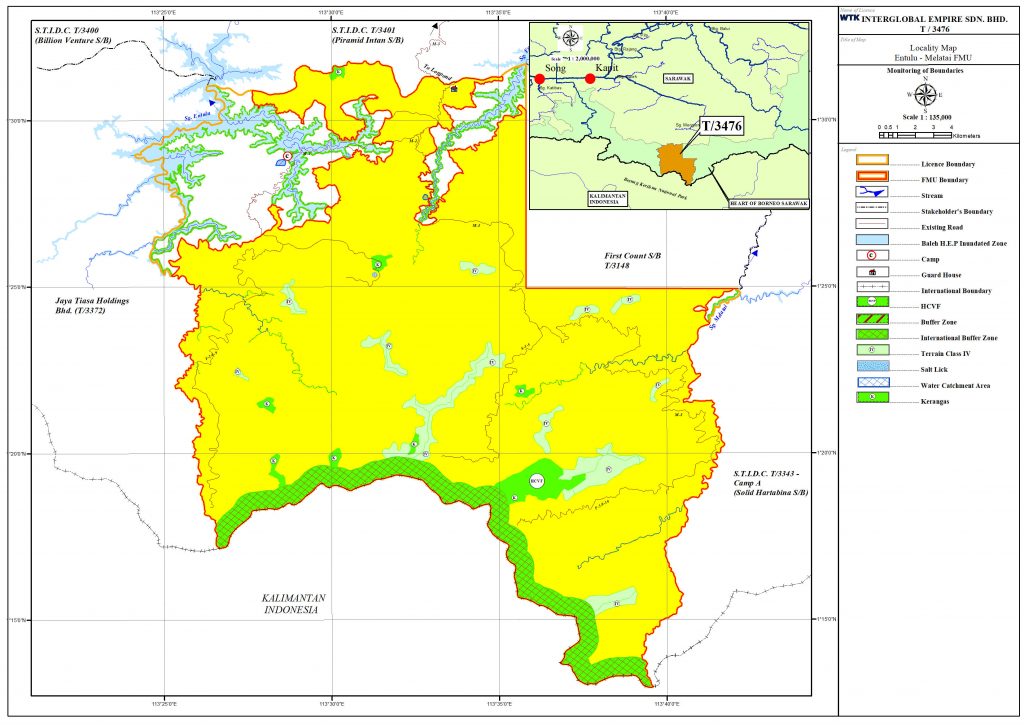
The Locality Map of the Entulu – Melatai FMU:
The FMU can be reached by road from Nanga Gaat, which is about 65 km upstream from Kapit Town.
The altitudes of Entulu – Melatai is ranging from 230 m at the lower hill areas to 1,800 m at highest spot at the Southwest tip above sea level next to Indonesia (Kalimantan) – Sarawak International Boundary.
The FMU is mainly covers by Terrain Class II and III, only few areas have steep dissected terrain with slope greater than 35o or Terrain Class IV which is too steep for conventional bulldozers based logging. The region has a tropical type of climate affected by the monsoon seasons, which is generally hot, wet and humid throughout the year.
Confirmed by Bukit Mabong District Office that there is no settlement within Upper Sg. Melatai – Sg. Entulu – Sg. Entuloh area.